
Explore this interactive GTA 6 map when you can find all locations, shops, properties, and activities in the game. You can mark locations as found and measure distance. In other words, explore GTA 6 in full detail. Check it out:
GTA 6 Map Guide TLDR:
-
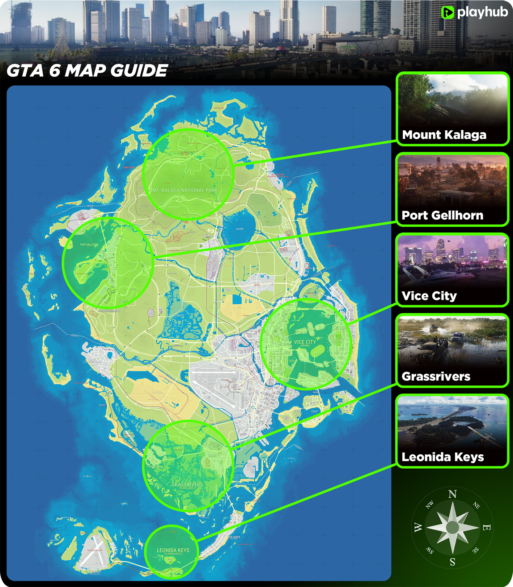
GTA 6 features the biggest map in the series, roughly twice the size of GTA 5, covering Vice City and the whole State of Leonida.
-
Vice City is the main urban area, based on modern-day Miami, and is split into East, West, North, and South parts, each with its own vibe, from neon beaches to the dense downtown and quieter northern neighborhoods.
-
Outside the city, Leonida offers a lot of variety, including the Leonida Keys, the Grassrivers wetlands, the gritty beach town of Port Gellhorn, industrial Ambrosia, and the forests of Mount Kalaga National Park.
-
Unlike GTA 5, there’s no single highway looping around the whole map, so the road network feels much less linear, and the world feels bigger to explore.
Ready to get into GTA 6? See the wide selection of GTA 6 accounts for sale on PlayHub, with all editions available. Start playing with all bonus content included!
GTA 6 Map & Locations Guide
GTA 6 takes place in the modern-day Vice City and features the biggest and most detailed map in the series. It’s the third game in the HD universe, and we could already visit this area in 2002 GTA Vice City. But that game is in the 3D universe, so the maps in GTA 6 and GTA Vice City are nothing alike. The scale and amount of detail in GTA 6 are unlike anything we’ve seen before. Not to mention that the map in GTA 6 doesn't end with Vice City alone, as you have the whole State of Leonida to explore. When compared to previous games, it is roughly twice the size of the GTA 5 map in total landmass, as confirmed by Rockstar in the EDGE Magazine feature. At first glance, the layout is very similar to GTA 5, and it makes sense because developers started working on the map concept and planning all the way back in 2014-2015 right after finishing the 8th gen version of the game. Some players even call it “GTA 5 map on steroids”. One of the main differences is that one main highway doesn’t go around the whole map anymore. This was one of the main criticisms of the GTA 5 map, with many players saying it made the map feel smaller than it actually is. GTA 6 has a far less linear road network. Now let’s take a closer look at the main areas of the map and what they offer.
Vice City
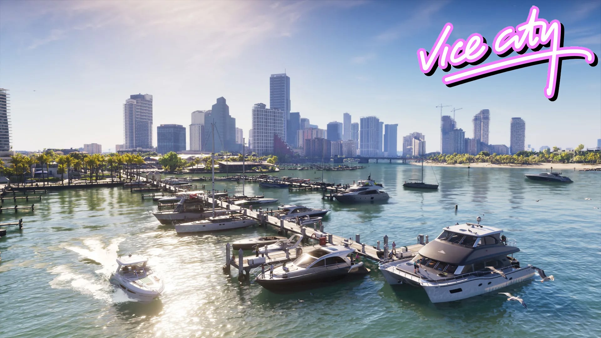
Vice City is the primary urban area in GTA 6, located on the southeast coast of the map. It is a representation of modern-day Miami, although many pointed out that, while working on the game, some buildings were demolished in real life, making the game a sort of time capsule of Miami in 2020-2022. With that being said, Vice City includes diverse neighborhoods, many iconic buildings, and landmarks. From iconic Vice City Beach (Miami Beach) to the industrial hub of Grapeland Heights, the city areas are very diverse.
East Vice City
This is the picture-perfect beachside area of Vice City, filled with neon lights, waterways, and luxury. East Vice City includes:
-
Vice Beach, Ocean Beach, & Washington Beach: The iconic sandy coastlines lined with Art Deco hotels.
-
The Islands: Highly affluent areas situated in the bay channels, including Starfish Island and the Rialto Islands. Dalton Island is an in-game representation of Fisher Island, known for having some of the most expensive and ultra-wealthy residential real estate.
-
Port Vice City: Located in the southeastern part. It is a massive hub for cruise and cargo ships.
West Vice City
Moving west away from the beaches, the city transitions heavily into a dense downtown area and urban industry before hitting open country. This part of the city includes:
-
Downtown: The business district, with areas like Crosstown, Rockridge, and Tequesta, makes up the dense commercial zone.
-
Residential Neighborhoods: This district includes residential neighborhoods like Little Cuba and Little Haiti.
-
The Industrial Area: The Stockyard district sits on the western fringe of the city proper, moving toward the industrial town of Ambrosia.
-
Vice City International Airport (VCIA): The massive airport and transport hub bordering the far western edge of the metropolitan area.
North Vice City
Heading north, the city slowly loosens up, trading high-rises and tourist crowds for quieter neighborhoods, green spaces, and the city limits.
-
Vice Point: The northern island and beach districts of Vice City, modeled after North Beach in Miami Beach, with a more laid-back feel than the busy beaches further south.
-
Bohemia: An artsy, laid-back neighborhood with a creative vibe, offering a nice change of pace from the glitz of the beachfront.
-
Leaf Links Golf Club: A sprawling golf course and one of the more upscale leisure spots in the northern part of the city.
This is where Vice-Dale County comes to an end, and the map transitions into Leonard County, as the urban sprawl gives way to the rest of Leonida.
South Vice City
South of downtown, Vice City takes on a greener, more relaxed waterfront vibe.
-
Peacock Bay: One of the most beautiful waterfront neighborhoods in GTA 6 Vice City, with its name and setting drawing from Miami’s Coconut Grove area, giving it a distinct coastal atmosphere.
-
Belville: A neighborhood located near Ekanfinaka that forms part of the city’s wider mainland landscape.
State of Leonida
Most of the Leonida area is rural and natural landscapes, with some smaller urban areas located in the west and south parts.
Leonida Keys
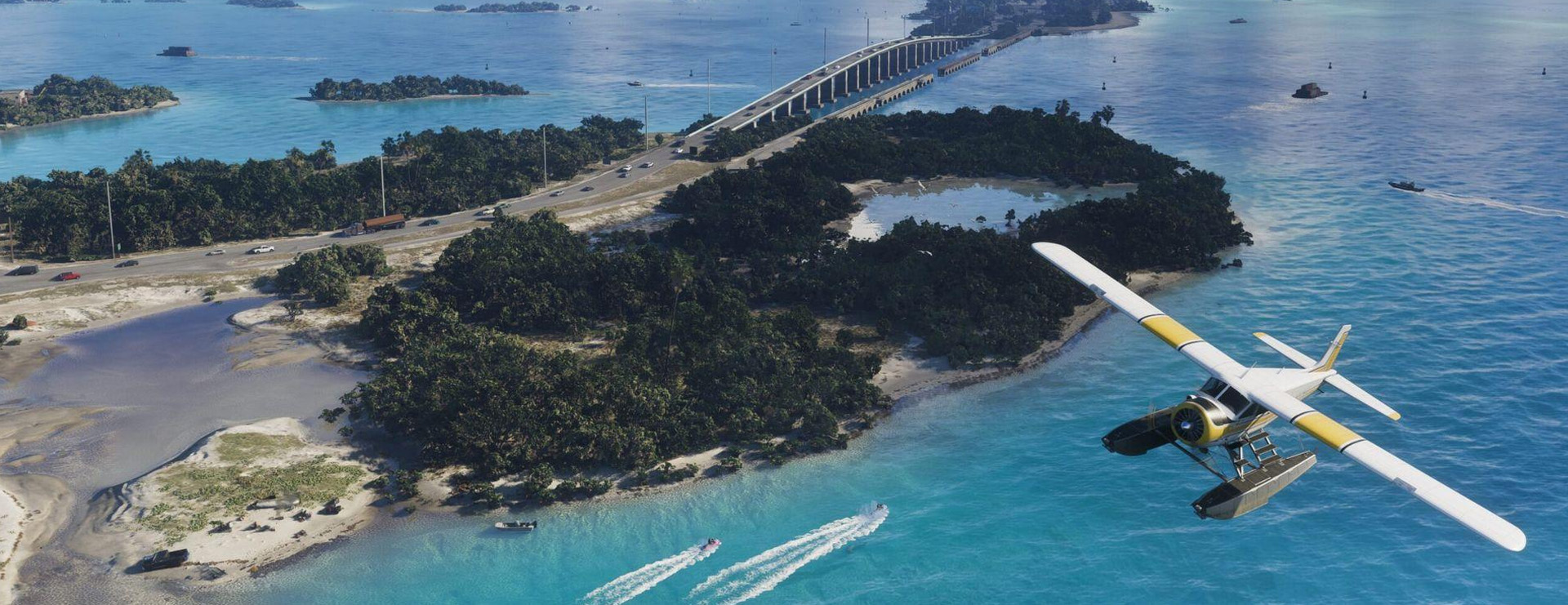
Leonida Keys in GTA 6 is located in the southern part of the map and is based on the real-life Florida Keys. It is a beautiful area with crystal-clear turquoise waters, white sand beaches, and massive bridges stretching into the horizon. This is also where the infamous Jason's house is located, so it’s not just nature here. There is Key Lento, a coastal town built around local boating and fishing businesses, and Goose Key with Naval Air Station.
Grassrivers
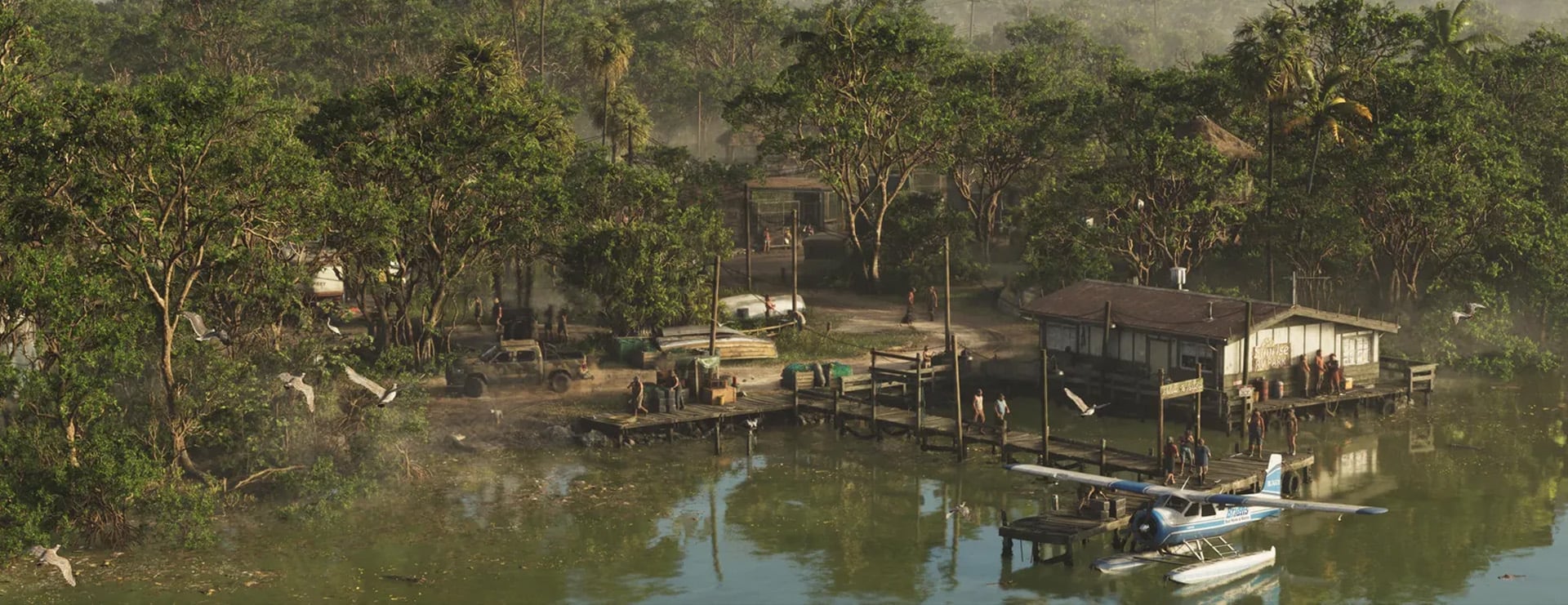
Grassrivers is GTA 6’s take on the Florida Everglades, a massive stretch of wild wetlands in the southwest part of the map. Expect swamps, tall grass, winding waterways, and plenty of alligators lurking just below the surface. Airboats are the best way to get around here, and since it’s so remote, it’s the kind of place where all sorts of shady business can happen far away from prying eyes.
Port Gellhorn
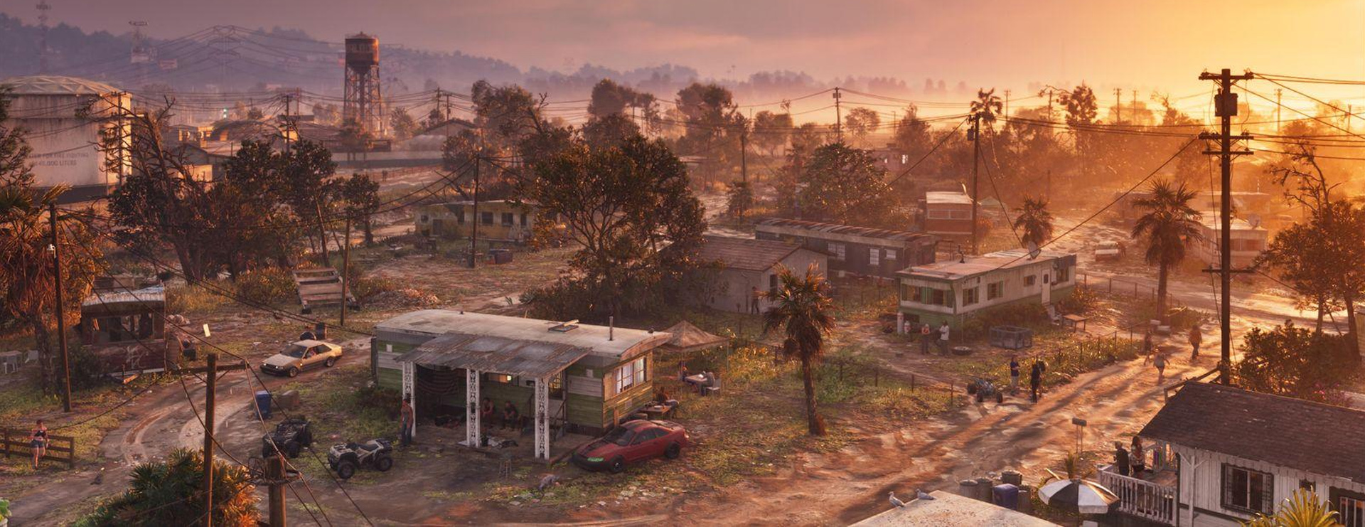
Port Gellhorn is located on the west side of the map, in Leonida’s Gulf Coast, and is inspired by the Florida Panhandle, with Panama City as its main real-life reference. It’s a forgotten beach town that has clearly seen better days, with rundown motels, empty strip malls, and a gritty, worn-out vibe that’s a far cry from the glamour of Vice City. One of its standout spots is the Gellhorn International Raceway, a big motorsport venue that’s perfect for anyone who wants to put the game’s cars to the test.
Ambrosia
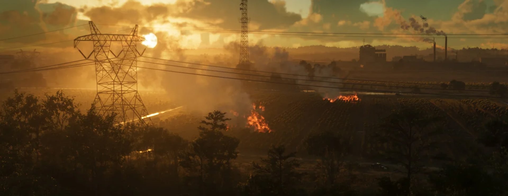
Ambrosia is a small industrial town in the heart of Leonida, built around its massive sugar refinery that towers over the area. It’s a working-class place surrounded by farmland and back roads, and it has a rough, small-town reputation, with bikers and outlaws calling it home. If Vice City is all neon and luxury, Ambrosia is the complete opposite.
Mount Kalaga National Park
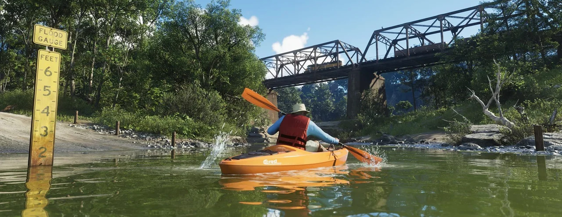
Mount Kalaga National Park is located in the northern part of the map and is the most nature-heavy area in Leonida. It’s full of dense forests, hills, rivers, and rocky trails, making it a great spot for off-road driving, hiking, hunting, and fishing. It’s quiet, beautiful, and the perfect place to escape the chaos of the city for a while.
This wraps up my GTA 6 map guide. Hopefully, it’ll all help you navigate the map more easily and have more fun exploring the game. Also, don’t forget to explore the interactive map, accounts for sale on PlayHub, and more guides on my blog:
